The 7 Days Shira Plateau Route Kilimanjaro Climb
The Shira Route is a little used trail that begins near Shira Ridge. It is nearly identical to the Lemosho route. In fact, Shira was the original route and Lemosho is the improved variation.
It is nearly identical to the Lemosho route. In fact, Shira was the original route and Lemosho is the improved variation.
Tour Highlights
- Remote and scenic northern approach
- Peaceful trail with minimal traffic
- Stunning views of Mawenzi and Kibo peaks
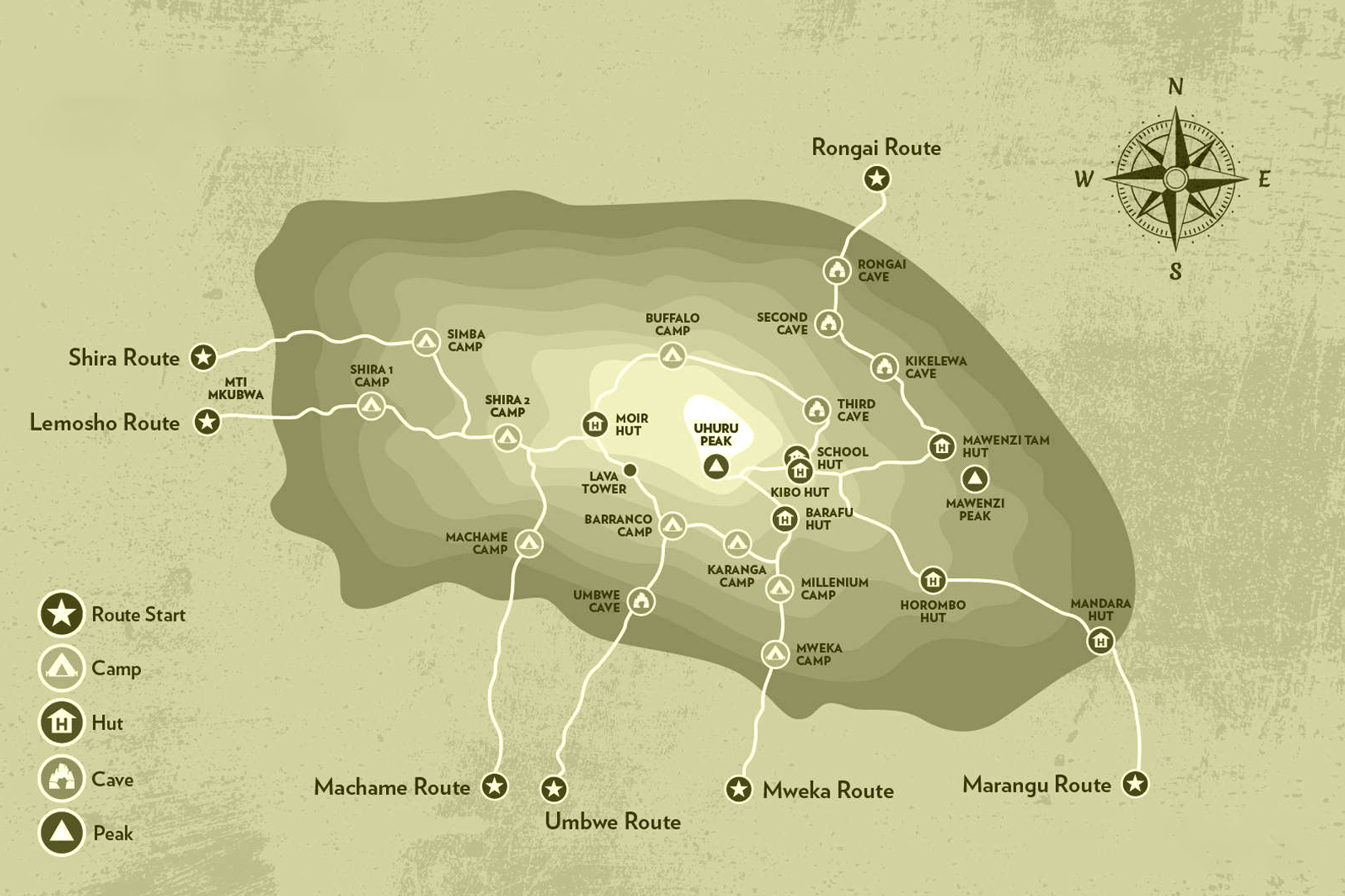
Route Map
Itinerary Overview
Day 1:Shira Gate to Simba Camp
Hiking time: 1-2 hours
Distance: 4 km
Habitat: Heath
We depart Moshi for Londorossi Gate, which takes about 4 hours; here we will complete entry formalities while guides and porters prepare equipment. We then continue to drive up a steep path to the Shira Gate where we will begin the hike. The trek starts through shrubs and giant heather until we reach Simba Camp.
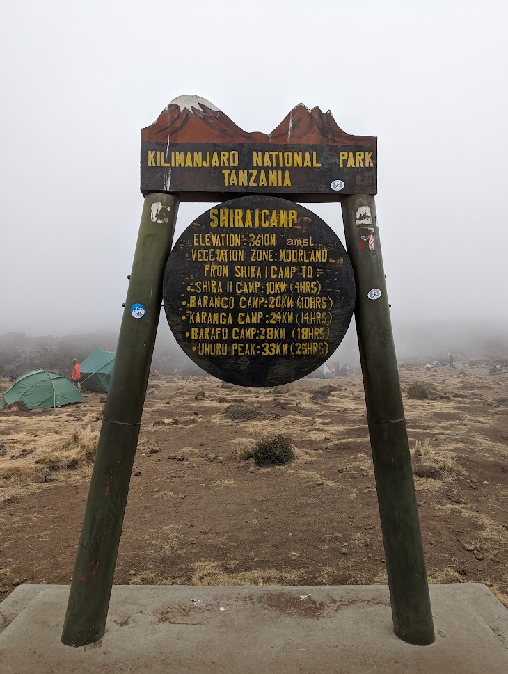
Day 2: Simba Camp to Shira 2 Camp ( 11,800 ft to 12,500 ft)
Hiking time: 2 hours
Distance: 6 km
Habitat: Heath Zone
Today is a fairly easy day to help with acclimatization. We begin by exploring the grassy moorland and volcanic rock formations on the plateau. Then we take a scenic path to the Shira Cathedral, a huge buttress of rock surrounded by steep spires and pinnacles, before settling at Shira 2 Camp.
Day 3:Shira 2 Camp to Lava Tower to Barranco Camp ( 12,500 ft to 15,190 ft)
Hiking time: 7-8 hours
Distance: 10 km
Habitat: Alpine Desert
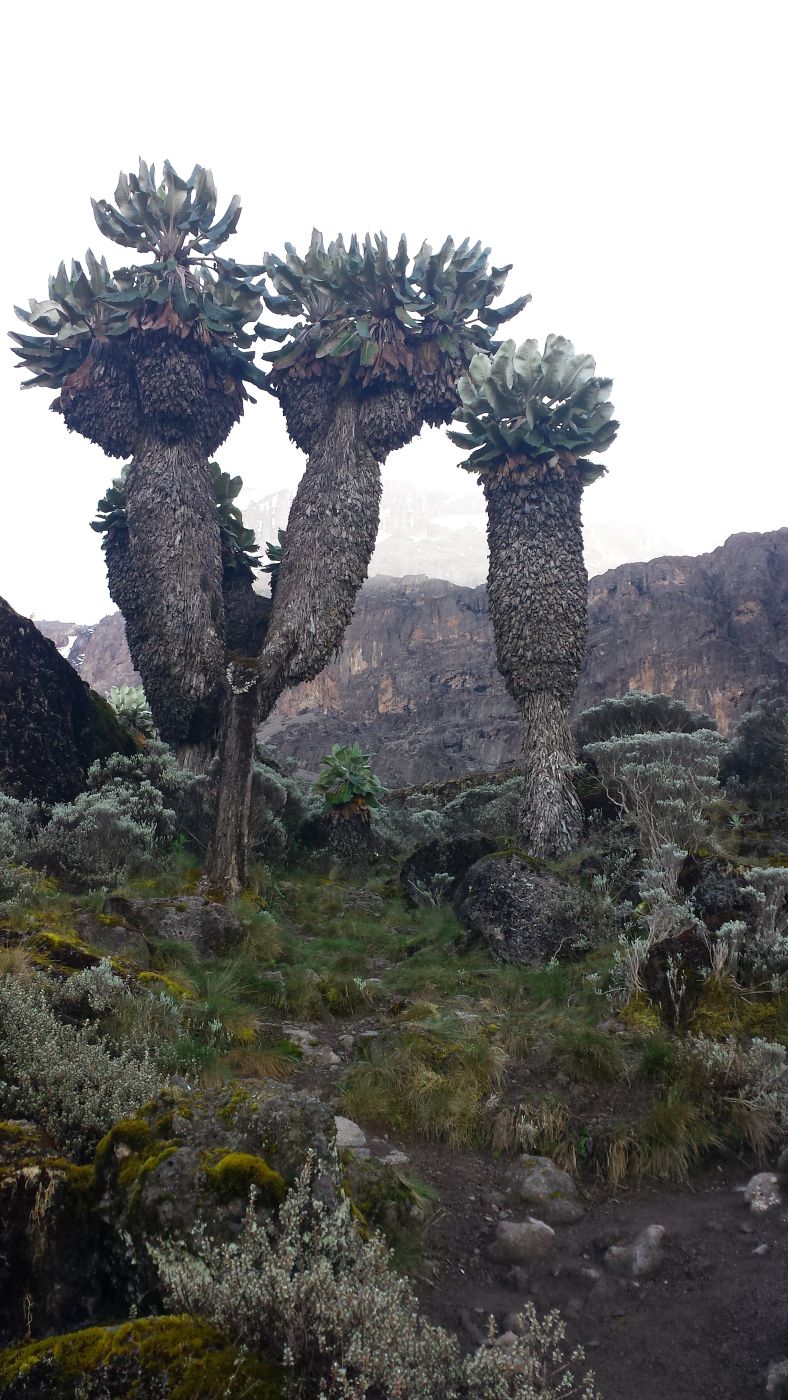
We continue to the east up a ridge and then head southeast towards the Lava Tower – a 300 ft tall volcanic rock formation. We descend down to Barranco Camp through the strange but beautiful Senecio Forest to an altitude of 13,000 ft. Although you begin and end the day at the same elevation, the time spent at higher altitude is very beneficial for acclimatization.
Day 4: Barranco Camp to Karanga Camp ( 13,044 ft to 13,106 ft)
Hiking time: 4-5 hours
Distance: 5 km
Habitat: Alpine Desert
We begin the day by descending into a ravine to the base of the Great Barranco Wall. Then we climb the non-technical but steep, nearly 900 ft cliff. From the top of the Barranco Wall we cross a series of hills and valleys until we descend sharply into Karanga Valley. One more steep climb up leads us to Karanga Camp. This is a shorter day meant for acclimatization.

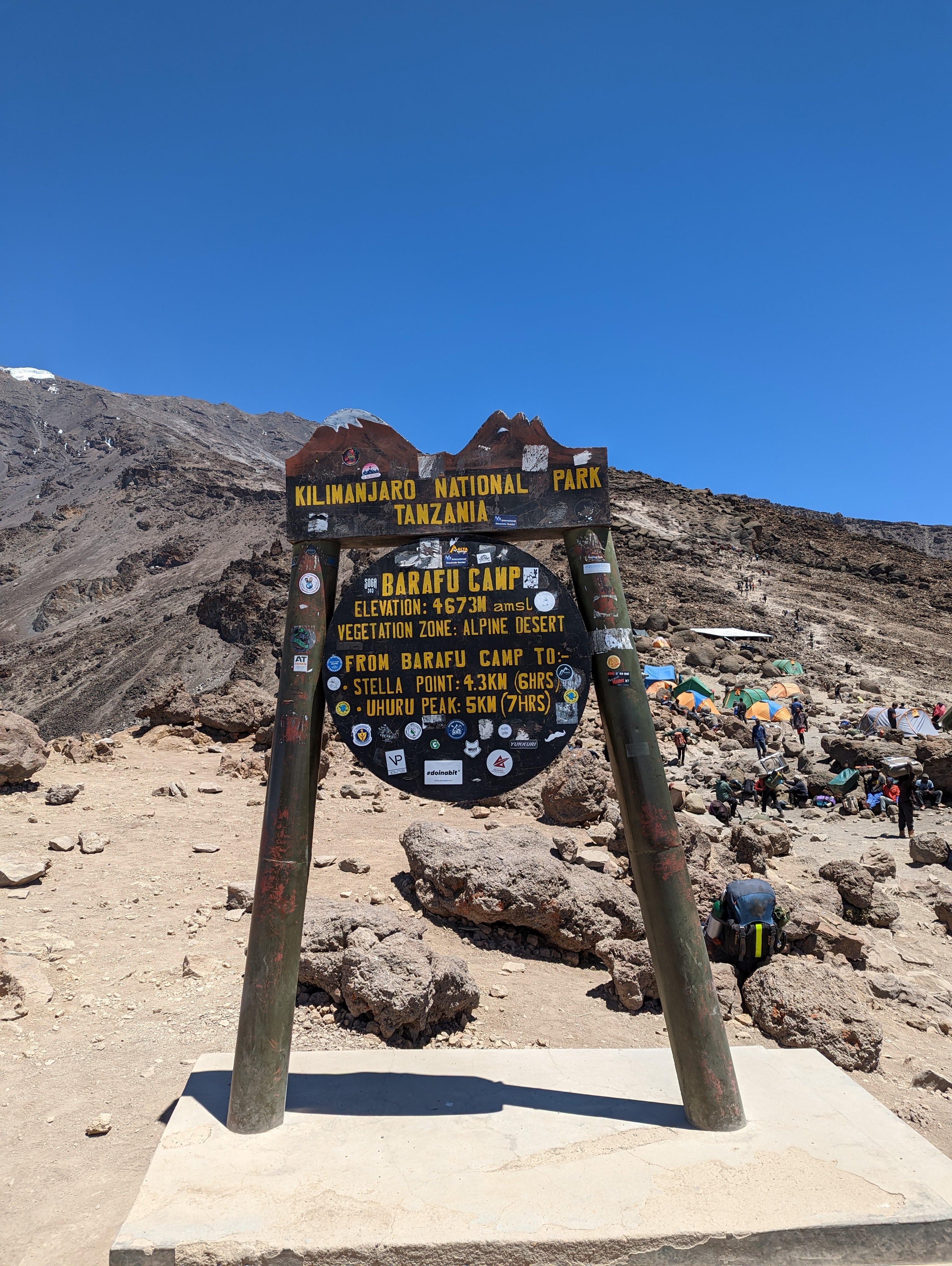
Day 5: Karanga Camp to Barafu Camp (13,106 ft to 15,331 ft)
Hiking time: 4-5 hours
Distance: 4 km
Habitat: Alpine Desert
We leave Karanga and hit the junction which connects with the Mweka Trail. We continue up to the rocky section to Barafu Hut. At this point, you have completed the Southern Circuit, which offers views of the summit from many different angles. Here we make camp, rest and enjoy an early dinner to prepare for the summit day. The two peaks of Mawenzi and Kibo are viewable from this position.
Day 6: Barafu Camp to Summit to Mweka Hut ( 15,400ft to 19,340ft (and down to 10,000ft) )
Hiking time: 7-8 hours ascent / 4-6 hours descent
Distance: 5 km ascent / 12 km descent
Habitat:Arctic/Alpine desert/Snow cape
Very early in the morning (midnight to 2am), we continue our way to the summit between the Rebmann and Ratzel glaciers. You head in a northwesterly direction and ascend through heavy scree towards Stella Point on the crater rim. This is the most mentally and physically challenging portion of the trek. At Stella Point (18,600 ft), you will stop for a short rest and will be rewarded with the most magnificent sunrise you are ever likely to see (weather permitting). From Stella Point, you may encounter snow all the way on your 1-hour ascent to the summit. At Uhuru Peak, you have reached the highest point on Mount Kilimanjaro and the continent of Africa. Faster hikers will see the sunrise from the summit. From the summit, we now make our descent continuing straight down to the Mweka Hut camp site, stopping at Barafu for lunch/change for less layers. You will want gaiters and trekking poles for the loose gravel going down. Mweka Camp is situated in the upper forest and mist or rain can be expected in the late afternoon. Later in the evening, we enjoy our fresh and celebratory dinner on the mountain and a well-earned sleep.
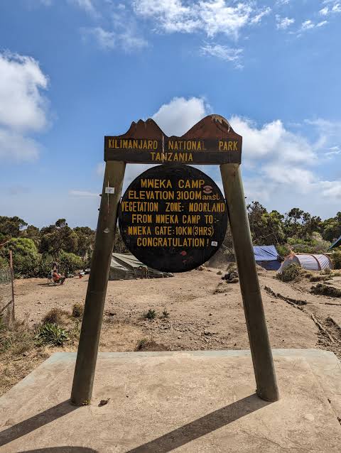
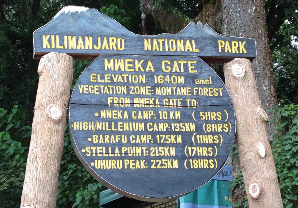
Day 7:Mweka Camp to Arusha ( 10,000ft to 5,500ft )
Hiking time: 3-4 hours
Distance: 10 km
Habitat: Rain Forest
After breakfast, we continue the descent down to the Mweka Park Gate to receive your summit certificates. At lower elevations, it can be wet and muddy. Gaiters and trekking poles will help. Shorts and t-shirts will probably be plenty to wear (keep rain gear and warmer clothing handy). At Mweka Gate we get time to sign out then Lunch when it will be prepared. The vehicle will be there ready to pick you and drive to the Hotel in Arusha for leisure, dinner and overnight. Some may depart on that same day depending on the schedule or continue to Safari part
Traveler Reviews
Leave a Review
Traveler Reviews
“Unforgettable experience! The Rongai Route was peaceful, and our guides were incredible. Reached the summit safely!”
- Sarah L., UK“Amazing scenery and great organization. Loved every moment from start to finish.”
- Michael K., USA